WE
NOW HAVE LESS THAN 10 OF THESE LEFT! If you'd like one, please
buy it now.
"This
is the best navigation bundle available for flight simulator
enthusiasts, period."
SimPlates
2004 is the best approach plate solution for pilots. There
are two basic CD-ROMs which include 18000+ actual IFR approach
plates.
But
what about en-route and other charts?
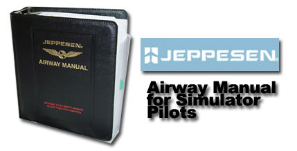
We
have for sale a limited number of Jeppesen Airway Manuals at
a very special price. The Jeppesen manual is an ACTUAL Jeppesen
manual used for training JAR flight crews for their "big
jet" ATPL certificates. The charts and content inside are
actual Jeppesen and of professional quality just like professional
pilots use.
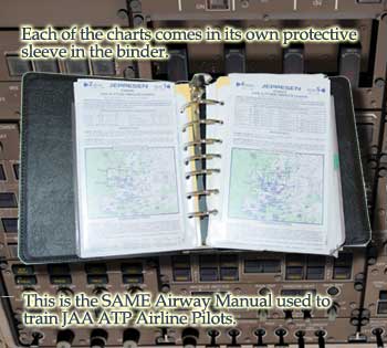
Inside,
you get the following:
-
An
180+ page introduction that serves as a reference and tutorial
for approach, enroute, and other charts.
-
Low
Altitude Enroute Charts
- E(Lo)
1A Covering Scotland, the Faeroes, and Parts of Norway
- E(Lo)
1 and 2 Covering All of England, Wales, most of Ireland,
bits of Belgium, and Northern France
- E(Lo)
5 and 6 Covering (at least part of the each of the following:
Belgium, the Czech Republic, Denmark, Northern Germany,
Northeast France, Latvia, the Netherlands, Poland, and
Sweden (and bits of UK Airspace)
- Atlantic
Ocean Orientation Charts 1 and 2 (H/L) covering the
Atlantic ocean from as far south as the north of South
America and Dakar in Senegal to Greenland in the North.
Includes coverage of most of the Eastern Seabord including
New York, Gander, Miami, Montreal, Bermuda, etc and
also all of the UK, parts of France and Spain, Portugal,
etc.
- United
States Low altitude Enroute Charts 45 and 46 covering
New Boston, New York City, Connecticut, Buffalo, and
much of middle New York State and northern Pennsylvania
- United
States Low altitude Enroute Charts 47 and 48 covering
the NYC area, Philadelphia, Baltimore, Washington DC,
all of Virginia and West Virginia, bits of Ohio, Pittsburgh,
much of Pennsylvania, etc.
-
High
Altitude Enroute Charts
- E(Hi)
1 and 2 covering bits of Scotland, Belarus, Denmark,
Estonia, Finland, Latvia, Lithuania, Norway, Poland,
Russia, and Sweden
- E(Hi)
3 and 4 covering most of the UK and Ireland, 2/3 of
France, much of Germany, Northern Italy, bits of the
Netherlands, Poland, Slovenia, all of Switzerland, and
more (Czech republic, Croatia, Belgium, etc).
- E(Hi)
4 and 5 with coverage similar to 3 and 4, but also including
the rest of France and more of Italy
- Canada-Alaska
(Hi) 3 and 4 covering Canada's Far north and also much
of Eastern Canada including Toronto, Ottawa, Winnipeg,
Montreal, Gander, Halifax, Bangor Maine, etc.
- US
(Hi) 4 and 3 covering the US from Maine to Michigan
to northern Arkansas to Virginia. Covers all of the
Northeast including NYC, Philadelphia, Washington DC,
etc. Also covers Chicago.
- AT
(Hi) 5, covering flying the North Pole!
-
Plotting,
etc Charts
- North
Atlantic Plotting Chart (2 of them.. They differ from
each other in the type of detail they provide)
- North
Canada Plotting Chart
- VFR+GPS
Chart ED-6 for Germany, covering Munich, Stuttgart,
Zurich, etc.
-
An
ICAO Air Traffic Control reference
-
Arrival
Charts, Paper approach Plates, Taxiway and Parking diagrams,
and more for Several Major World Airports:
-
Schiphol, Netherlands
- London
Heathrow, UK
- Madrid
Spain
- Munich,
Germany
- New
York JFK, USA
- Paris
Charles de Gaulle, France
- Zurich,
Switzerland
-
finally
there is a VFR reference and Guide as well as VFR arrival
and area charts for a few European airports.
It
really is a superb package. Keep in mind that the paper Jeppesen
charts typically cost not less than around $15 each.
|
|
© 2026 Dauntless Aviation • 4950C York Road 110, Buckingham, PA, 18912, USA •
Contact Us •
Privacy Policy / Terms / Conditions
|
|

